Hem Heath Woods - A Timeline
Introduction
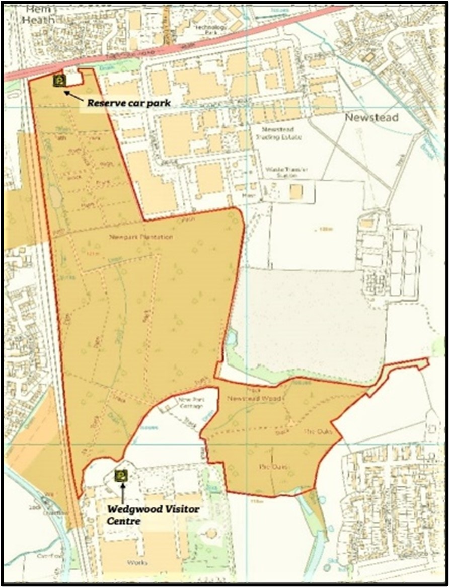
Today Hem Heath Woods is a popular local nature reserve owned by the Staffordshire Wildlife Trust.
The woodland covers an area of 100 acres and is one of the largest woodlands in Stoke-on-Trent. The current woodland comprises four historic areas:
1. New Park Plantation, which was planted for commercial purposes in the mid 1800s on former farmland.
2. Hem Heath Woods, a more recent name given to the area nearest the car park and originally part of the former farmland.
3. Newstead Woods, on the eastern side of the woodland, was planted in the early 1830s and fringed the boundary with Newstead Farm, now the industrial estate.
4. The Oaks, at the southern end and near to the Wedgwood Visitor Centre, is known to have been woodland for 400 years, and had been leased by the Trentham Estate
since at least 1763.
This timeline aims to illustrate some of the key events in the woodland's history.
1600s
In the 1600s the area now known as Hem Heath Woods consisted of large irregular fields with the names of Brend (or Burnt) Heath and Whrethornes (or Horthornes) and was covered in furze and gorse and used to pasture sheep and cattle. The land is believed to have been part of the Trentham Estate owned by the Leveson-Gower family since 1540.
Slightly to the north was the unenclosed common land of Hem Heath Common which later became the site of Hem Heath Colliery.
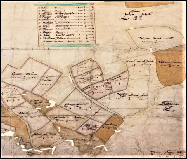
1599 map of Hem Heath, Sutherland Papers, Staffordshire Record Office
1700s
The Yates map of 1775 shows the outline of the New Park which lay to the south of the Trentham to Blurton Road.
The 1775 Yates map also shows the line of the Trent and Mersey Canal, constructed in 1771-2,
and which cuts through the southwest corner of New Park. In addition, the road from Trentham to Longton was turnpiked in 1771, mainly at the instigation of Earl Gower,
and this new road runs along the north of New Park and is also shown on map from 1775.
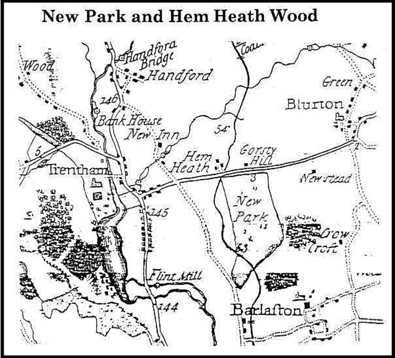
Yates map of 1775, Staffordshire Record Office
On the instructions of the Trentham Estate Land Agent, this land had been enclosed in May 1752 by William Hughes who erected a Park Pale,
(a wooden fence); the Trentham estate account books show he was paid £3 10 shillings for this work.
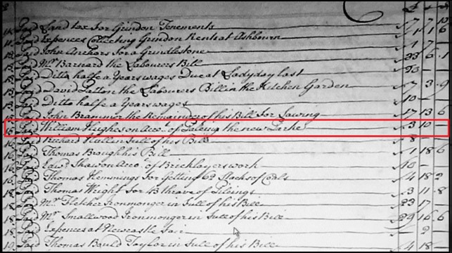
Sutherland Papers, Staffordshire Record Office
The land was known to be of poor quality as a consequence of inadequate drainage and some improvements were made by creating ditching and drainage channels
and by the planting of new trees.
By 1763 Lord Gower of Trentham Hall was renting 12 acres of mixed woodland, situated to the south of New Park, from Thomas Mills of Barlaston Hall;
this formed an extension to New Park and is the area that became known as The Oaks.
By the 1780s New Park had become a farm with a tenant farmer, although the Trentham Estate retained six acres of beech tree planting
alongside the newly turnpiked Trentham to Longton road and an area of tree plantation almost in the centre of the Park amounting to 5 acres.
These areas of tree planting, (and the Oaks,) can be seen on the map.
John Mills is believed to have been the first tenant farmer of New Park Farm and he died at New Park in 1792.
From the late 1700s the Trentham Parish Registers record events in the lives of labourers at New Park - for example the birth of Jacob Salt in 1788,
and his brother Abraham born in 1791, both children of Isaac and Elizabeth Salt; Isaac is described as a labourer at New Park.
Map from early 1800s, Sutherland Papers, Staffordshire Record Office
1800s
By 1796 the tenant of the 295 acre New Park Farm was Isaac Aston who began works to further improve the land and undertook repairs of the farmhouse and farm buildings
which were completed by 1816. By 1820 Thomas Aston had inherited the tenancy of New Park Farm from his father Isaac.
In an account of improvements to the Trentham Estate published in 1820, James Loch, the land agent for the Trentham Estate reported that when Thomas Aston was the farmer,
there was a mixture of dairy and arable. There had been a large amount of draining and ditching because "the soil was very much inclined to wet".
The repeated efforts to ditch and drain the New Park land is thought to explain the many ditches to be found in the woodland now.
The Aston's tenancy was followed by John Gibbs in 1826 and James Perkins in 1838.
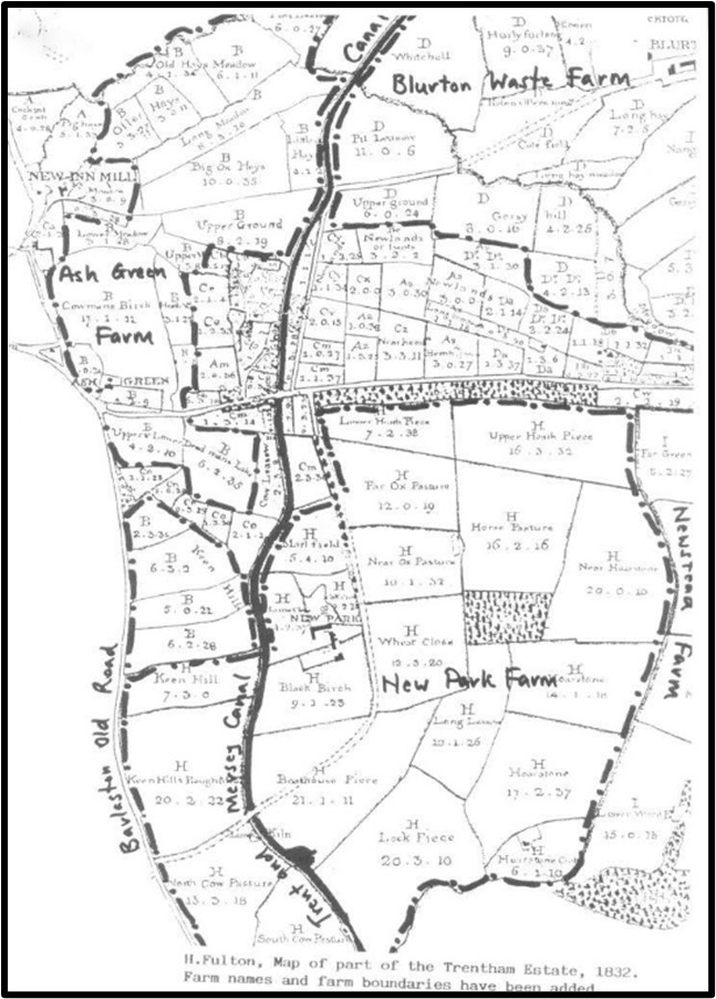
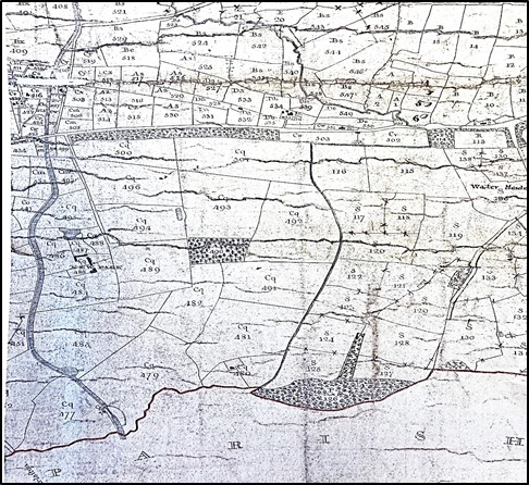
Fulton Map of 1832, Staffordshire Record Office
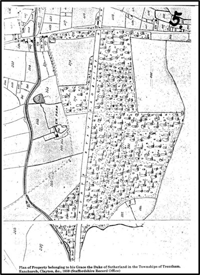
1859 Map showing New Park after the development of the railway and the planting of woodland
to form the New Park Plantation, Staffordshire Record Office
In 1847, the construction of the North Staffordshire Railway split New Park Farm in two and James Loch, the Land Agent, decided that the Trentham Estate would be
responsible for the area to the east of the railway and a small area to the west and this was planted with trees and became known as New Park Plantation.
New Park Farm now consisted of only 48 acres and the 1851 Census shows it was tenanted by George Cooper, a farmer, and his family,
who farmed the land with one labourer. However, by the time of the 1861 Census the farm is being tenanted by Thomas Llewellyn who is an Attorney and Solicitor
and subsequently the farm continues to be tenanted by professional gentlemen for whom farming was a sideline.
The 1851 Census shows that two cottages within the Plantation area were occupied, one by a game keeper and his family and another by the Salt family who are known,
from entries in the Trentham Parish Register, to have lived in New Park since at least 1788.
Joseph Gorse, the Gamekeeper in 1851, occupied Newpark Cottage which was situated on the eastern edge of the New Park Plantation,
adjoining Newstead Farm. By 1859 the Gamekeeper was John Simcock who is also recorded in the 1861 Census.
The other cottage, known as New Park Cottage, was situated to the south of the Plantation on open land adjoining Newstead Wood and The Oaks
and was built by 1836. In 1851 this was occupied by Elizabeth Salt, a widow, listed as Head of the family.
Her son Joseph was aged 25 years and employed as an Under Usher at Trentham Hall. 1n 1851 Elizabeth's son Abraham Salt was listed as a Brickmaker,
living in Longton but he was appointed Woodsman for the Plantation in 1852 and moved into New Park Cottage;
in the 1861 Census, Abraham Salt is listed as the Head of the family. Abraham Salt continued as Woodsman for the Plantation until his death in 1879.
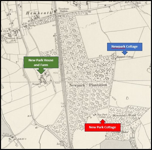
Map showing location of cottages and farm, 1878, 6 inch Ordnance Survey Map
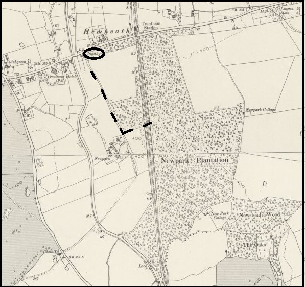
Map showing original access route, 1878, 6 inch Ordnance Survey Map
Throughout the 1700 and 1800s access to the New Park Plantation had been via a track adjacent to the Hem Heath Smithy and close by the canal.
This was upgraded to a carriage way in 1858-59 by George LLewellyn, the then tenant of New Park Farm, who also built an entrance lodge
(the chimneys of which can still be seen peeping over the hedge on Longton Road) near to the junction of the carriageway and the Trentham to Longton road.
Following the building of the railway, access to the Plantation was from the track through New Park Farm and over a railway bridge.
New Park Plantation was a commercial enterprise as part of what was now the Duke of Sutherland's Trentham Estate and by the time the trees were ready for felling and sale,
the railway bridge was not a suitable exit route for deliveries. The account books from the Trentham Estate show regular sales of 'cratewood' for use in the pottery industry
and to facilitate deliveries to the pottery manufacturers in the Longton area, a new access road, situated in the northeast corner of the plantation,
was built directly onto the Trentham - Longton turnpike road in the early 1870s This access road eventually became the main route into the woodland
and the railway bridge was demolished.
1900s
In 1904 -5 there was a dispute about the right of way (shown in red on the map),
over the carriageway and cart track leading from the Trentham - Longton Road down to New Park Farm
and on across fields to the Trent and Mersey Canal and then on to Tittensor.
On the 26th August 1904 there was a protest against the closure of this route by the Trentham Estate removing stiles and imposing barriers.
In addition, a number of notices saying "No road: trespassers will be prosecuted; by order Trentham Office" had been erected.
No explanation for the closure had been given.
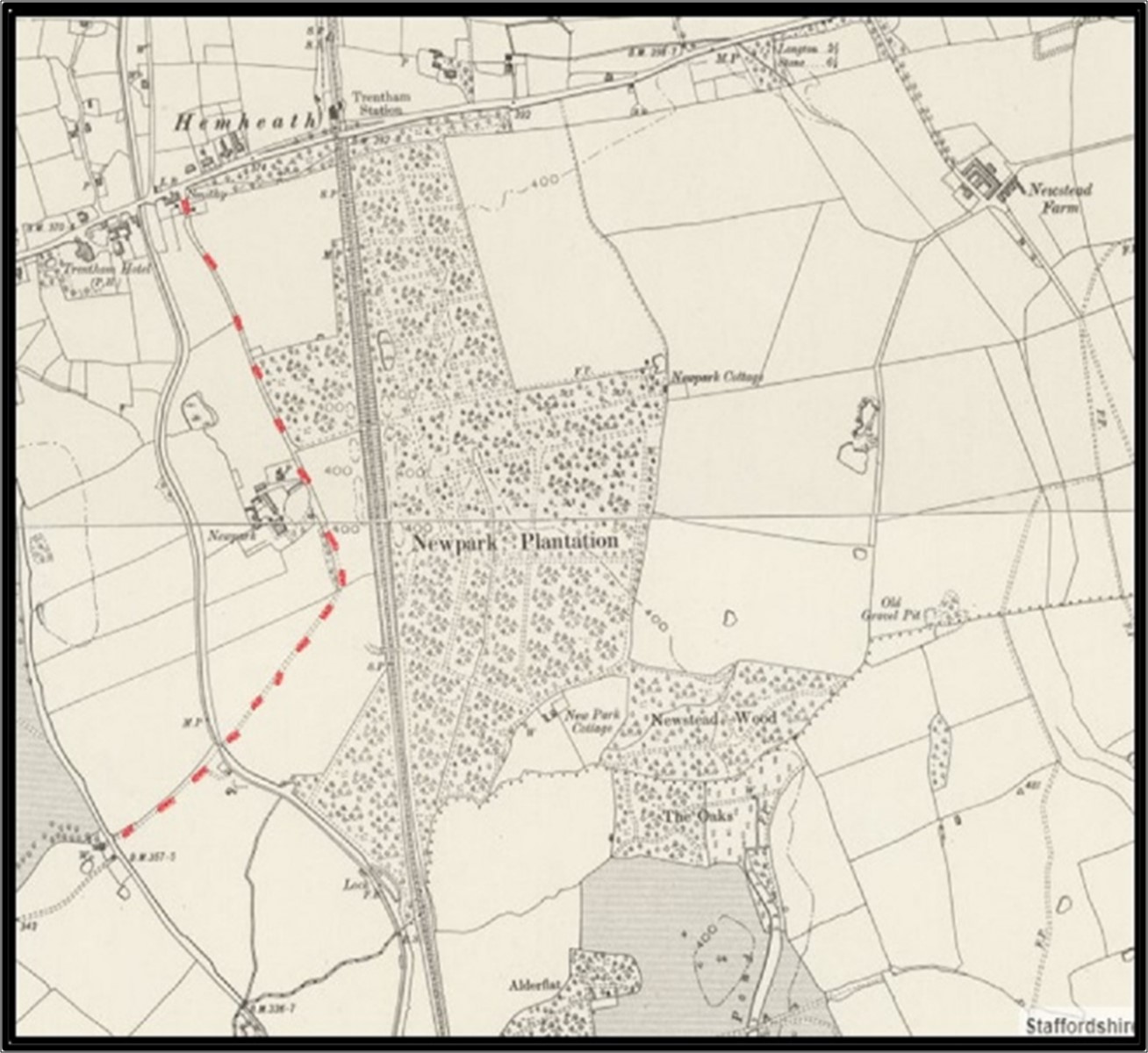
Map showing disputed right of way, 1878, 6 inch Ordnance Survey Map
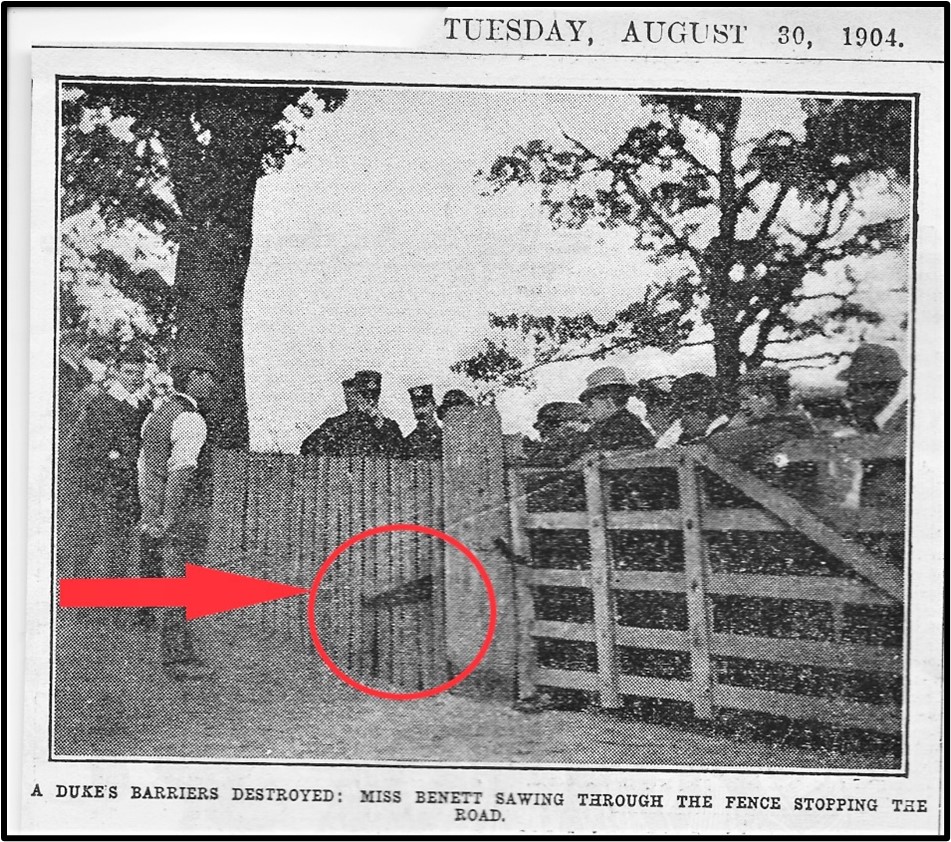
Picture of the protest from Daily Graphic
The protestors, led by Sarah Bennett, (a suffragette and union activist), argued that the route had been "an ancient and much- valued right of way" for over 300 years.
The protestors planned to reopen the right of way by taking "the constitutional means of doing this by removing the barriers".
Sarah Bennett proceeded to cut the links on chains fastening two gates and used a saw to remove "fixed oaken rails" on the old road to Barlaston.
In the subsequent court action, the Duke of Sutherland lost the first stage of the proceedings but his appeal was granted by the Lord Chief Justice
and so the route was closed to public use in 1905.
In 1905 the Sutherland family left Trentham Hall and the Hall was offered to the City of Stoke. This offer was refused and subsequently the Hall was demolished in 1911-1912.
The first major sale and auction of land and property from the Trentham Estate took place in 1914 but the outbreak of World War 1
halted the disposal of further Trentham Estate land at the time.
Developments following 1919 Auction of Trentham Estates
In 1919 a further sale and auction took place at King's Hall in Stoke from 14th - 16th October and this included the properties at New Park Farm (Lot 204),
the smaller area of New Park Plantation to the west of the railway (Lot 208), Newstead Farm (Lot 243, which included the Newpark Cottage,
previously the dwelling occupied by gamekeepers in the woods), the larger area of the plantation to the east of the railway line (Lot 244) and New Park Cottage (Lot 245).
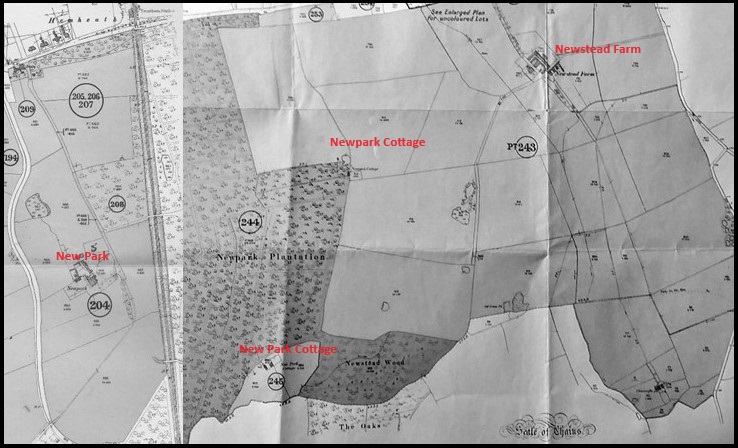
Map from 1919 Auction Catalogue of Trentham Estates
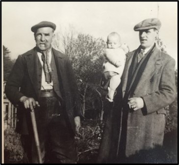
Photo courtesy of the Horrobin family
New Park Cottage (Lot 245)
By March 1909 Joseph William Horrobin is listed in the Trentham Estate Rental Books as a woodsman and in the 1911 Census when aged 27 years,
his dwelling is identified as New Park Cottage. During World War 1 he enlisted with the North Staffordshire Regiment and served as a Private in the Balkans.
The photo shows Joseph William Horrobin, his son Joseph and grandson Graham.
In the 1919 auction New Park Cottage and smallholding was purchased privately by Joseph William Horrobin for £600 and the family continued to occupy the property for many years.
This photo, dated around 1919 shows Emily Horrobin, wife of Joseph, with their two daughters, Ethel and Mary, and their baby son Joseph.
New Park Cottage is believed to have been occupied until the 1990s but has since fallen into ruins and there is little trace of it in the woods today.
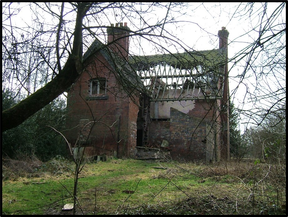
New Park Cottage Photo 2006 courtesy of Alan Walker
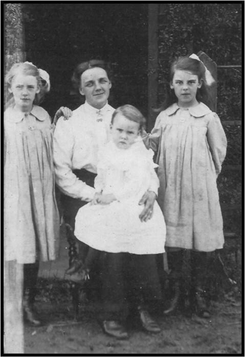
Photo courtesy of the Horrobin family
The New Park Plantation which included the woodlands known as New Park
and Newstead Woods, was purchased by the Staffordshire Coal and Iron
Company for £4,000. In July 1924 the company began the development of Hem
Heath Colliery on land opposite the woodland. It is believed that the company
used wood from the woodland area for the manufacture of pit props for the
developing colliery. The lease for the ancient woodland to the south, known as
the Oaks, was transferred at the time of the auction sale from the Trentham
Estate to the Staffordshire Coal and Iron Company.
Nationalisation of the coal mines in 1947 meant that the National Coal Board
then owned the woodland area. By then the ancient woodland known as The
Oaks had been sold when the Broughton- Adderley Estate in Barlaston was
purchased by the Wedgwood Company in 1936 but The Oaks continued to be
leased to the NCB.
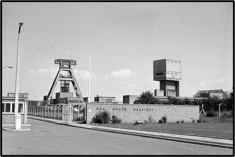
Hem Heath Colliery, 1964, Bert Bentley
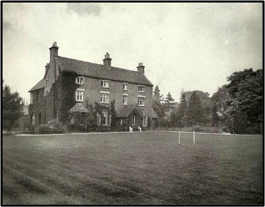
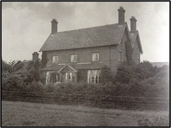
New Park Farmhouse from the 1919 auction catalogue
New Park House and Farm (Lots 204 and 208)
New Park, including the farm and the smaller area of plantation,
were purchased by J. C. Bailey for £7,000 in a private sale, rather than at public
auction. J. C. Bailey was the manager of Doulton's Burslem Works and had
moved into New Park with his family in the early 1900s and rented it until its
purchase in 1919. He died there in 1929.
In 1936 Joseph Tellwright purchased New Park from the Bailey family. The original house was completely demolished and a new house built.
A significant feature was a stained-glass window of 40 panels depicting Staffordshire's industries, buildings, events and personalities.
Joseph Tellwright was a pottery owner of Biltons Ltd in Stoke. He remained at New Park until his death in 1966.
In 1950 he placed stone markers around the boundaries of the estate with his initials and the date.
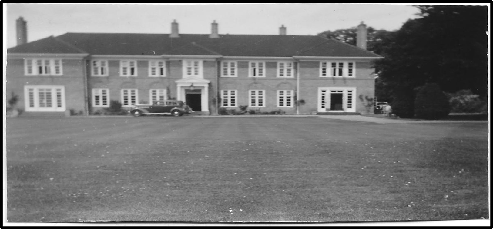
New Park House rebuilt for Joseph Tellwright
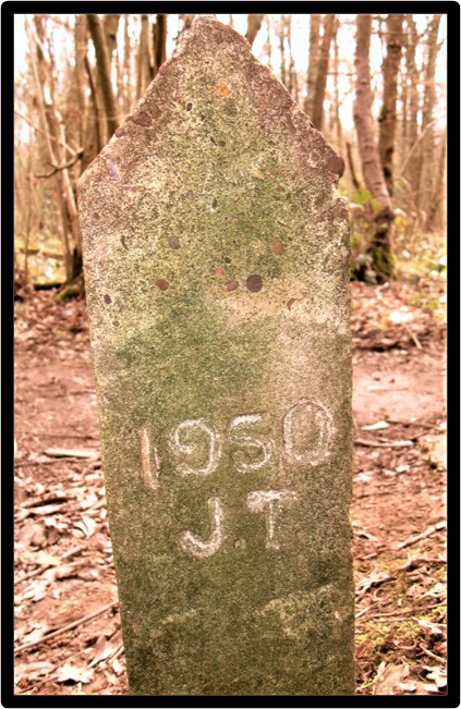
Stone markers
Subsequently, the Teachers Benevolent Fund converted the building into a care home for retired teachers; and the house continues
to provide residential care for older people as the Trentham House Care Home.
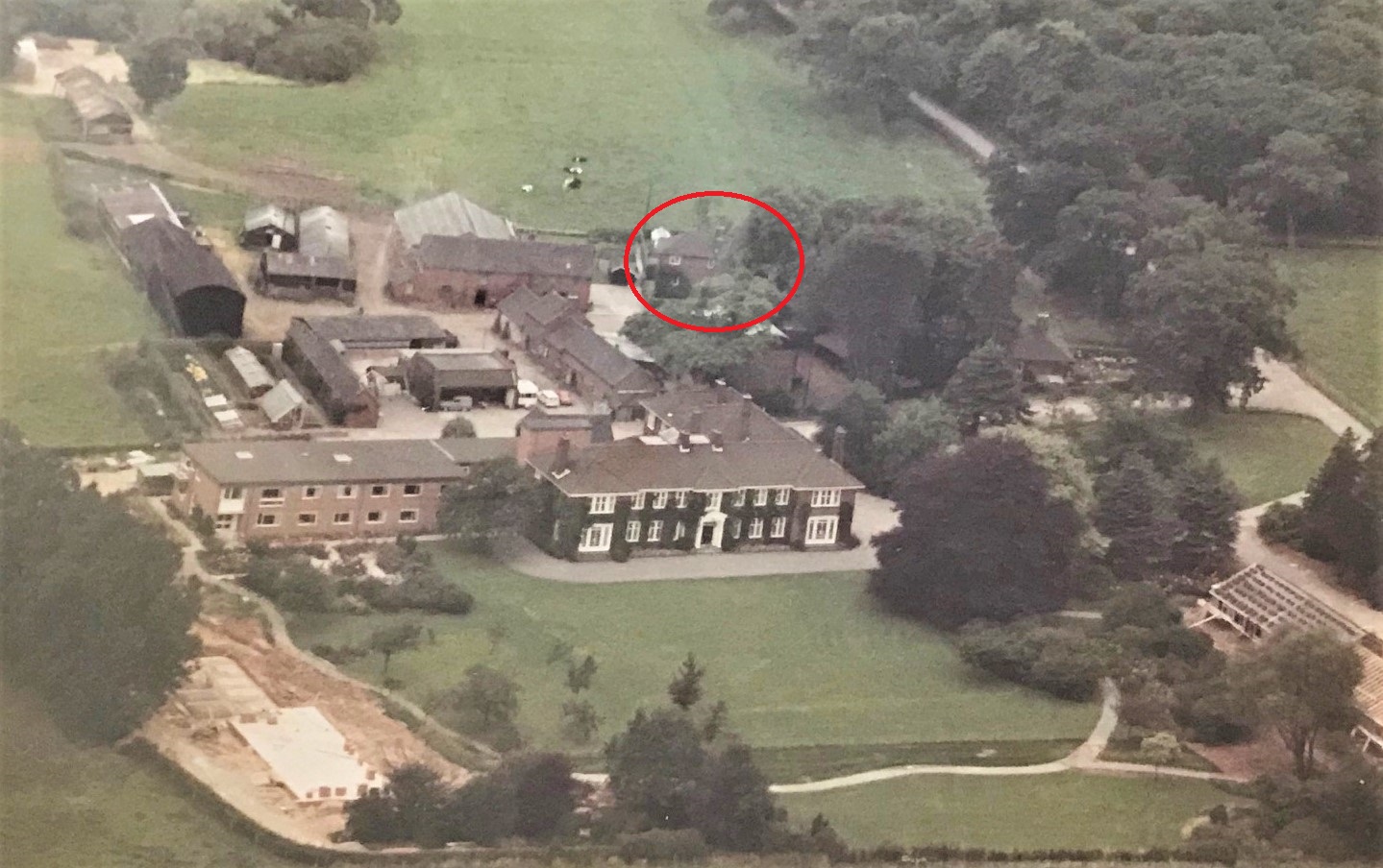
Arial view of New Park and farm buildings c1970 courtesy of Mike Smith
The adjacent farmland and farmhouse to New Park had been managed by a bailiff for Joseph Tellwright, but in 1957 John Fairbanks took over the tenancy.
The above aerial view of New Park house and farmstead is from the early 1970s and the farmhouse is circled in red.
The Fairbanks family left the farm and the area in 1976. The land and farmstead were subsequently sold for building and developed as the New Park housing estate.
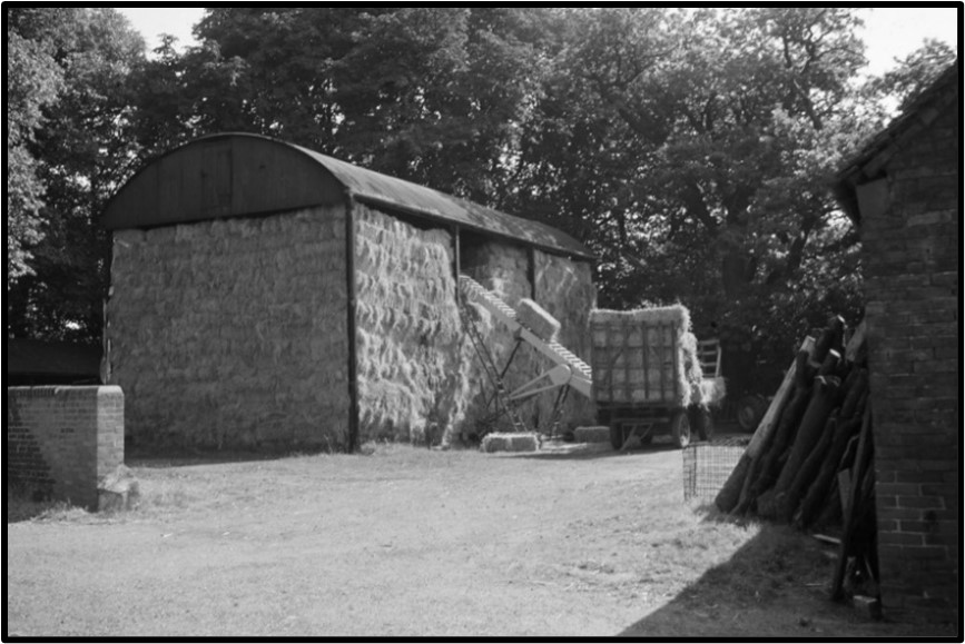
Bringing in the hay at New Park Farm, 1964 Bert Bentley
Newstead Farmhouse from 1919 auction catalogue
Newstead Farm (Lot 243)
Newstead Farm was sold to T Holdcroft for £15,000. At some point this land was purchased by a water/sewage company,
later Severn Trent Water, and Newstead Sewage Works was developed here but this was closed in the early 1940s
and subsequently the land released for the building of 800 homes on the Newstead Estate and the development of the Newstead Industrial Estate.
The cottage, once lived in by the gamekeepers, which was sold in 1919 as part of Newstead Farm, appears to have disappeared without trace during the 1900s.
Map showing location of Newstead Sewage Works, Newstead Industrial Estate and Newstead Housing Estate
The continuing development of Hem Heath Colliery and the Newstead
Industrial Estate led to the neglect and deterioration of the whole woodland
area in the mid to latter part of the 20th century. However, there had always
continued to be some public access to the woodland and concerns about its
preservation and management. By the late 1970s/early 1980s the Staffordshire
Nature Conservation Trust had leased 20acres of the woodland which they
managed and cared for with working parties and by organising nature trails
and walks.
From 1989 the SNCT was known as the Staffordshire Wildlife Trust and they
continued to lease the 20 acres of woodland from the National Coal Board and
following the closure of Hem Heath Colliery in 1997, from the Coal Authority,
and maintained public access to the woodland.
2000s
Staffordshire Wildlife Trust Purchased the land known as New Park Plantation
(comprising the woodlands known as New Park and Hem Heath Woods) in
August 1999 from the Coal Authority. This was followed by the purchase of the
coppice and area to the south known as Newstead Woods from Severn Trent in
September 2002. From the time of their first purchase in 1999 the
Staffordshire Wildlife Trust had continued to lease and manage the area of
ancient woodland known as The Oaks from the Wedgwood estate and were
able to purchase this area, including the newt reserve, in January 2018.
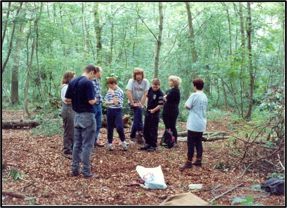
Volunteers working in the woodland - photo courtesy of Jon Heal
Staffordshire Wildlife Trust "has reinstated traditional woodland management on this nature reserve to ensure wildlife
can thrive here and to make it into a fantastic place to visit" (SWT leaflet). Given the close proximity of housing and industry in the locality,
the local population is fortunate that this area of woodland has never, whether by accident or design, been developed
and that it can therefore continue to be enjoyed by them for the foreseeable future.
Staffordshire Wildlife Trust
Acknowledgements
This Timeline is based on previous research by Andrew Dobraszczyc and Jon Heal and we thank them both for allowing us to access their material.
Further research was carried out by members of the Trentham Heritage Project at Stafford Record Office and through online sources.
We would also like to thank those people who have shared their personal histories and photos which help to tell the story of Hem Heath Woods.
We would welcome hearing from you if you have any further information or photos to share about the history of Hem Heath Woods.
If you notice any errors in the timeline then please contact us and we will correct them.


